


GREAT NEWS FOR MIAMI-DADE COUNTY
The National Hurricane Center is forecasting that powerful Category 4 Hurricane Dorian will move north. At this time Dorian is NOT expected to make landfall in Miami-Dade County.
Miami-Dade County is no longer in the cone of concern.
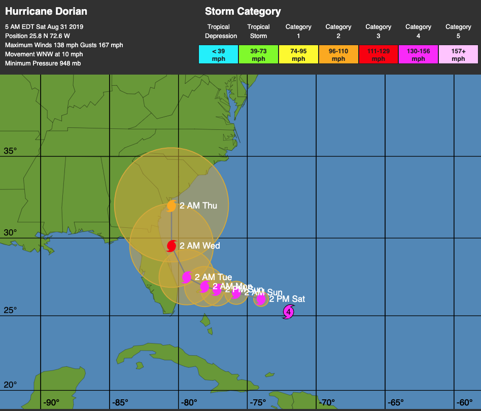
Nevertheless, until the storm clears our area, it’s important to keep an eye on it. We are still likely to see squally weather and a high probability of tropical storm force winds. We can still lose power as a result of this very powerful hurricane which has maximum sustained winds of 140mph.
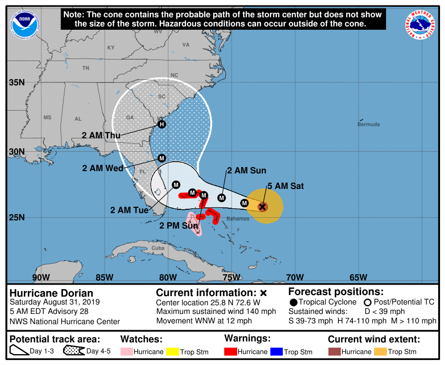
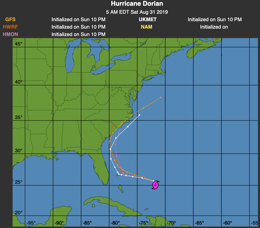
As you can see, the models below are aligned in that the hurricane is likely to take a northerly track (similar to Hurricane Floyd) and bypass Florida.
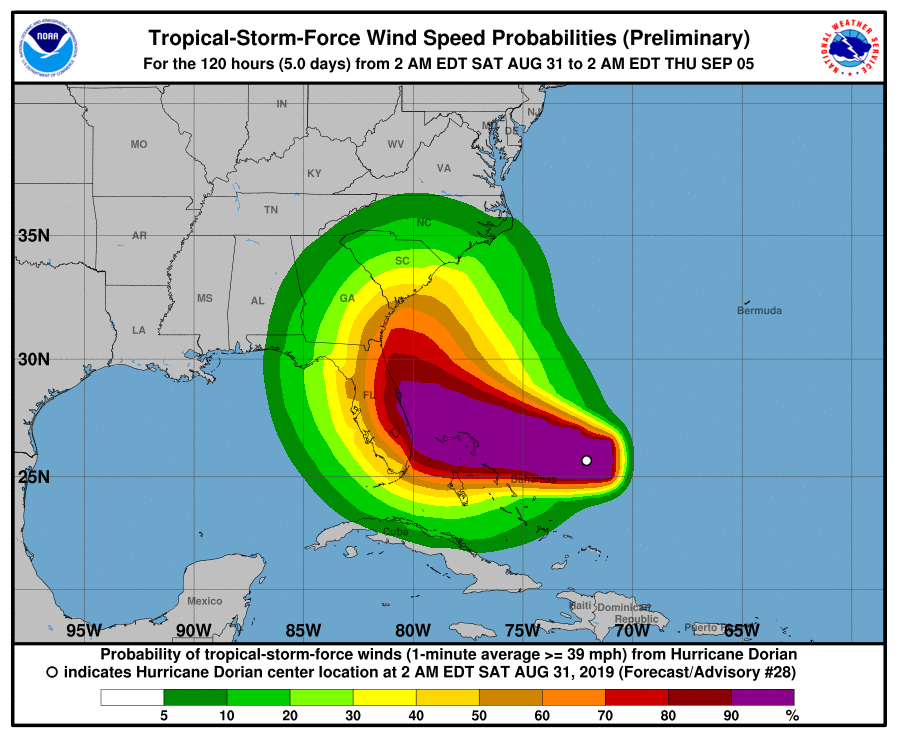
The chances of Miami Springs getting Tropical Storm force winds remains high. Any time we get Tropical Storm Force winds, we can lose trees which bring down power lines. According to the National Hurricane Center, we have about a 63% chance of getting Tropical Storm force winds in Miami Springs. That’s better than the 80% chance we had yesterday. See the graphic below.
Bottom line, stay tuned to the forecast, but I think we can take a huge sigh of relief if the hurricane continues to follow the prediction models.
HURRICANE PARTY
There’s a party tonight open to everyone at the Miami Springs Country Club. VIVA will be performing LIVE at Hole 19, the new Scratch Kitchen and Bar.


