


As of Saturday morning’s forecast from the National Hurricane Center, it appears that Hurricane Isaias will stay over the Bahamas as it passes to the east of Miami-Dade County. Miami-Dade County is still under a Tropical Storm Warning and we are expected to see tropical storm force winds later in the day.
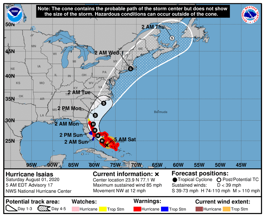 As you can see in the chart below produced by the National Hurricane Center, the earliest we’ll see tropical storm force winds would be at 8am Saturday morning as squalls begin to make their way across the Florida peninsula.
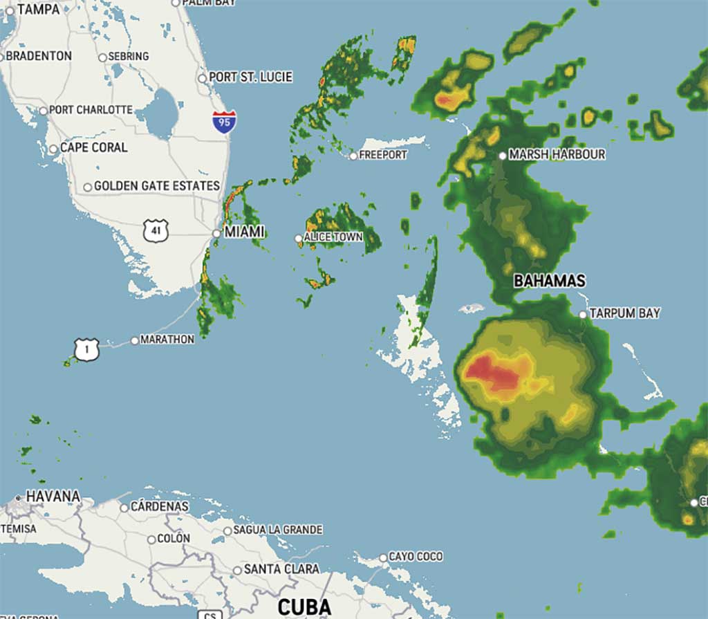
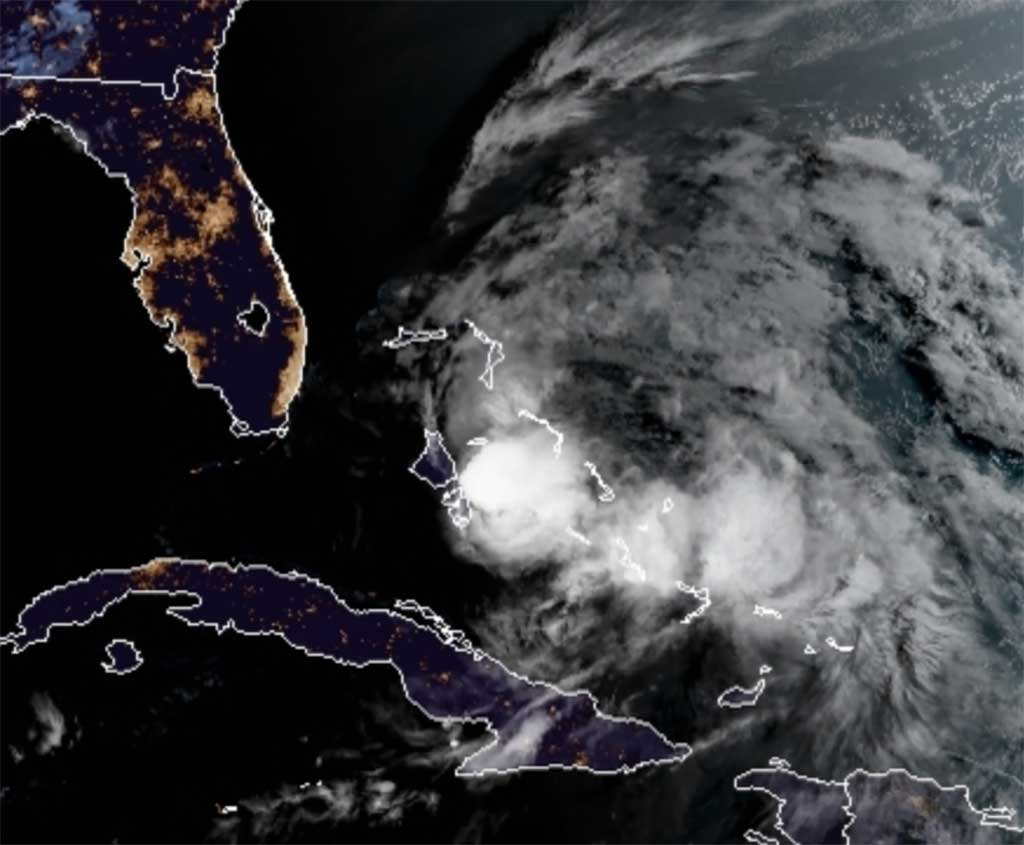
 Early morning radar was showing the hurricane with heavy rains over the Bahamas. Fortunately, it appears the worst of the hurricane will stay away from us for the rest of the day.
The National Weather Service did issue a significant weather advisory this morning of a significant weather advisory that included wind and heavy rainfall. This advisory will expire at 8:15am.
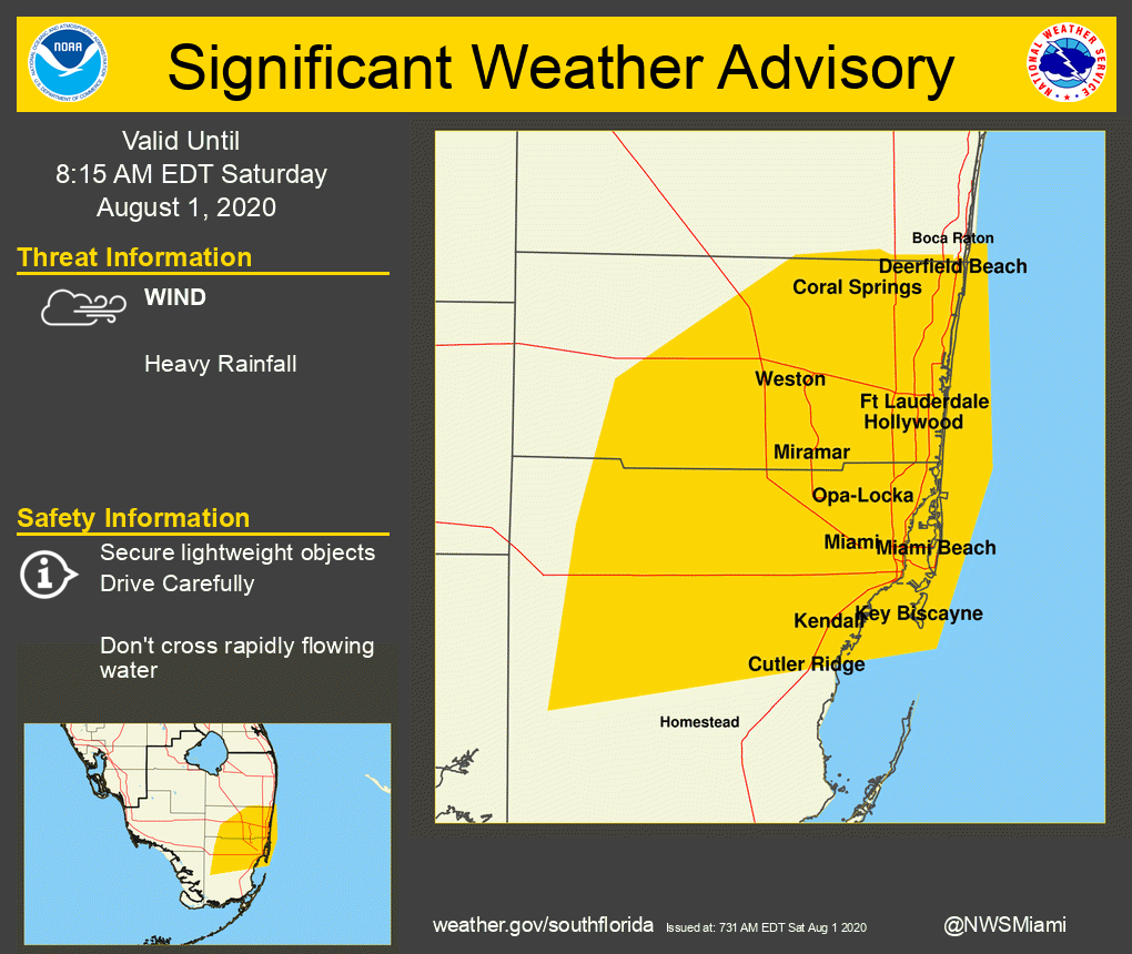
Significant Weather Advisory: Significant Weather Advisory for Northern Miami-dade and Broward Counties until 815 AM EDT. https://t.co/L6KxGAGsG1 #flwx pic.twitter.com/pIr2eunzKN
— NWS Miami (@NWSMiami) August 1, 2020
Please stay tuned as we’ll update on weather alerts throughout the weekend. Stay safe.
")


