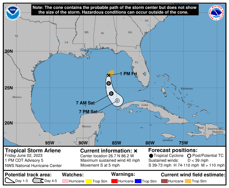
The first Atlantic storm of the 2023 Hurricane Season has officially formed in the Gulf of Mexico. The National Hurricane Center issued a special advisory announcing the formation of Tropical Storm Arlene.
Fortunately, the current southerly track has the Tropical Storm weakening back to a depression as it heads towards Cuba. Of course, we need to keep an eye on the storm should it strengthen and then turn back north towards Florida.
NATIONAL HURRICANE CENTER INFORMATION ON TROPICAL STORM ARLENE:
WATCHES AND WARNINGS
——————–
There are no coastal watches or warnings in effect.
DISCUSSION AND OUTLOOK
———————-
At 100 PM CDT (1800 UTC), the center of Tropical Storm Arlene was
located near latitude 26.7 North, longitude 86.2 West. Arlene is
moving toward the south near 5 mph (7 km/h) and this motion is
expected to increase slightly through tonight.
Maximum sustained winds have increased to near 40 mph (65 km/h)
with higher gusts. Arlene is expected to weaken by tonight, and it
is forecast to degenerate into a remnant low on Saturday.
Tropical-storm-force winds extend outward up to 70 miles (110 km)
northeast of the center.
The estimated minimum central pressure based on data from the Air
Force Hurricane Hunters is 1002 mb (29.59 inches).
HAZARDS AFFECTING LAND
———————-
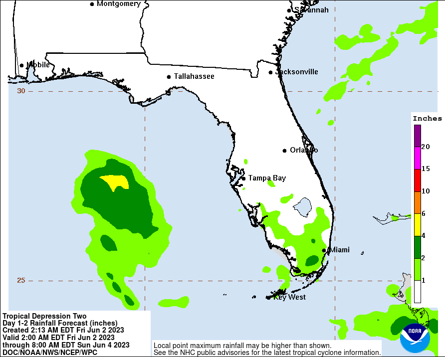
RAINFALL: Rainfall amounts of 1 to 2 inches with localized higher
amounts up to 5 inches are possible through Saturday across portions
of the central and southern Florida Peninsula. This rainfall is not
directly related to Tropical Storm Arlene. Regardless, the heavy
rainfall could lead to isolated flash, urban, and small stream
flooding impacts.
DISCUSSION:
Data from the Air Force Hurricane Hunters indicate that the
depression has strengthened into a tropical storm. On the last leg
of the current mission, the aircraft found maximum 925
mb flight-level winds of around 50 kt and SFMR surface winds of
around 35 kt. Based on these data, Tropical Depression Two has
been upgraded to Tropical Storm Arlene with estimated peak winds of
35 kt.
Although the storm has strengthened slightly, we still expect
Arlene to weaken soon due to increasing wind shear and dry air, and
no change has been made to the forecast. The next forecast will be
issued at the normal time at 4 pm CDT.


