

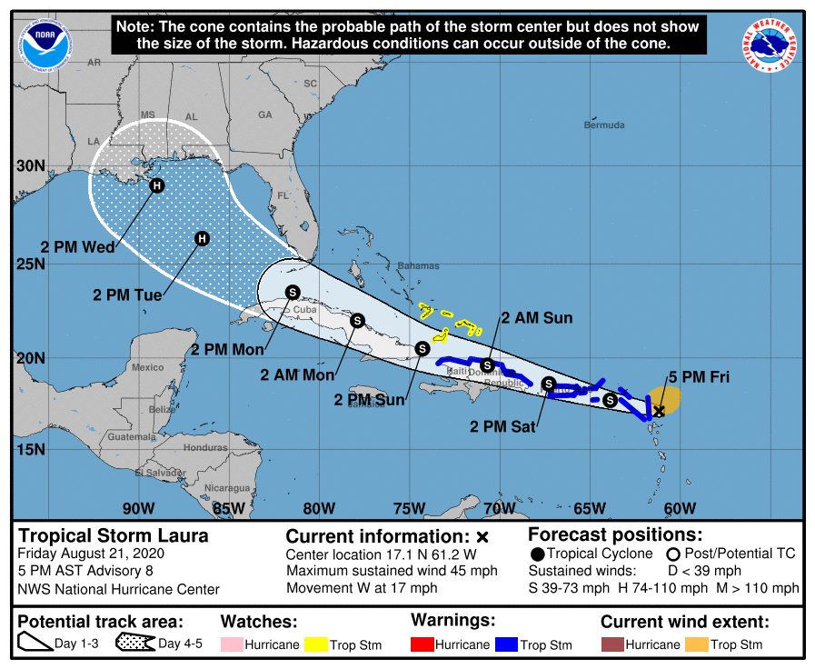
UPDATE: 5PM August 21
The storm track has moved further south. Miami Springs is now out of the cone. The National Hurricane Center is also forecasting Laura to track as a Tropical Storm as it approaches the Florida Keys. This is all good news right now. Nevertheless, we need to stay tuned over the weekend should the storm start tracking back north. But the news going into the weekend is much better.
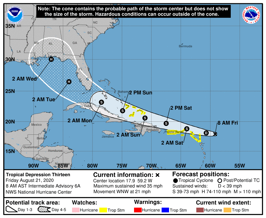
UPDATE: 8AM August 21

The storm track has moved south and west. Miami Springs is still within the cone of uncertainty and if it does move south of us, we will be on the dirty side of the storm. It may approach us as a tropical storm or hurricane.
Message from the National Hurricane Center: The details of the long-range track and intensity forecasts are more uncertain than usual since the system could move over portions of the Greater Antilles this weekend. However, this system could bring some storm surge, rainfall and wind impacts to portions of Hispaniola, Cuba, the Bahamas, and Florida this weekend and early next week. Interests there should monitor this system’s progress and updates to the forecast over the next few days.
Based on the National Hurricane Center models, the storm would be approaching us on Monday, August 24th. As you know, that’s the same day and date as the catastrophic Hurricane Andrew of 1992. Fortunately, this storm is expected to reach our area with either tropical storm force or category 1 hurricane force winds and no where near as strong as Andrew.
Nevertheless, we know we can lose power from a regular thunderstorm, so if we get tropical storm force winds in the area, there’s a good chance of losing power on Monday.
This weekend will be a great opportunity to monitor the storm more closely and make storm preparations as needed.
And if you’ve forgotten what a category 5 hurricane can do, here’s a little reminder of what Hurricane Andrew did to South Dade back in 1992.


